New Google Maps Images Reveal Massive Scale of Devastation in Gaza
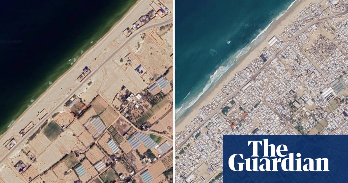
Satellite imagery shows further destruction of homes, businesses and places of worship since fragile ceasefire
TL;DR
- Google Maps images from June show extensive destruction in Gaza, impacting homes, businesses, places of worship, and infrastructure.
- Huge tented camps and makeshift accommodation are prevalent along the shoreline and in open spaces, with Gaza City heavily impacted.
- Northern towns like Beit Lahiya and Beit Hanoun, along with neighborhoods in Gaza City such as Jabaliya and Shuja’iya, are uninhabitable.
- The town of Rafah appears almost entirely reduced to rubble, and Tel al-Sultan has been razed.
- Over 2.1 million displaced people are in tents and temporary shelters, with about 82% of structures damaged and two-thirds destroyed.
- The UN estimates 61 million tonnes of rubble, significantly more than in global conflicts over the past 18 years.
- The presence of human remains buried under rubble is a pressing humanitarian issue.
- The war has resulted in over 74,000 Palestinian deaths in Gaza since October 2023, following a Hamas attack on Israel.
- The Hamas attack in October 2023 killed approximately 1,200 people in Israel and took 251 hostages.